History of Wildfires in El Dorado County
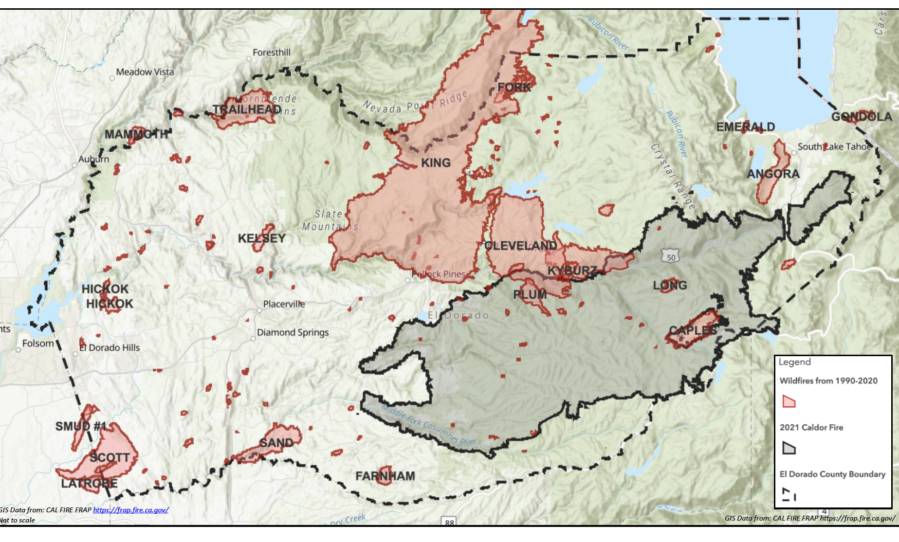
In the late summer of 2021, El Dorado County experienced the largest wildfire in the County for the last 30 years, the Caldor Fire. The Caldor Fire burned 347 square miles and lasted for two months. The next largest fire, the King Fire, burned 153 square miles in 2014, half of the area of the Caldor Fire. The locations and names of wildfires in El Dorado County from 1990-2021 can be seen below.

Half of the most destructive wildfires in the County have occurred in the last 10 years. The King Fire in 2014 burned 97,717 acres and destroyed 12 homes; the 2014 Sand Fire destroyed 19 homes; and the 2007 Angora Fire destroyed 254 homes (EDC, 2020). The Caldor Fire destroyed 1,003 structures and damaged 81.
Today, the Mosquito Fire is raging in parts of El Dorado County and Placer County. The fire has burned for only 6 days so far an has consumed 78 square miles. The last time a fire burned in that area of the County was the King Fire in 2014.
The County has 13 agencies that provide fire services with assistance from CAL FIRE and the USFS as well as neighboring agencies in neighboring counties. The majority of the agencies are struggling to fund enough firefighters on shifts to meet the national and state standards. Smaller numbers of firefighters on shifts are seriously deficient in keeping ahead of wildfire and slower for key activities in relation to fire suppression than higher staffed fire companies.
For more information on the state of fire agencies click here.
